AUTO-FREE NEW YORK!
Home
Glossary
Light Rail
Regional Rail
Penn Station
Livable City Plan
Books
Links
Donate
AUTO-FREE NEW YORK!
| |||||||||
Home |
Glossary |
Light Rail |
Regional Rail |
Penn Station |
Livable City Plan |
Books |
Links |
Donate |
|
Last updated: April 14, 2017. |
The Bridges of New York City
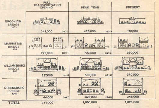 This diagram of cross-sections -- admittedly hard to see -- of the East River bridges - 'People Crossing Daily' - is copied from a rare, out-of-print book, Spanning the 21st Century: Reconstructing a World Class Bridge Program, published by the NYC Dept. of Transportation, back in 1988. The number at the center of each box shows the number of people crossing daily at the year shown in parentheses. The Full Transportation Opening shows when the bridge was first fully opened, the Peak Year shows the bridge at peak number of people crossing, and the Present shows daily people crossings in 1988. 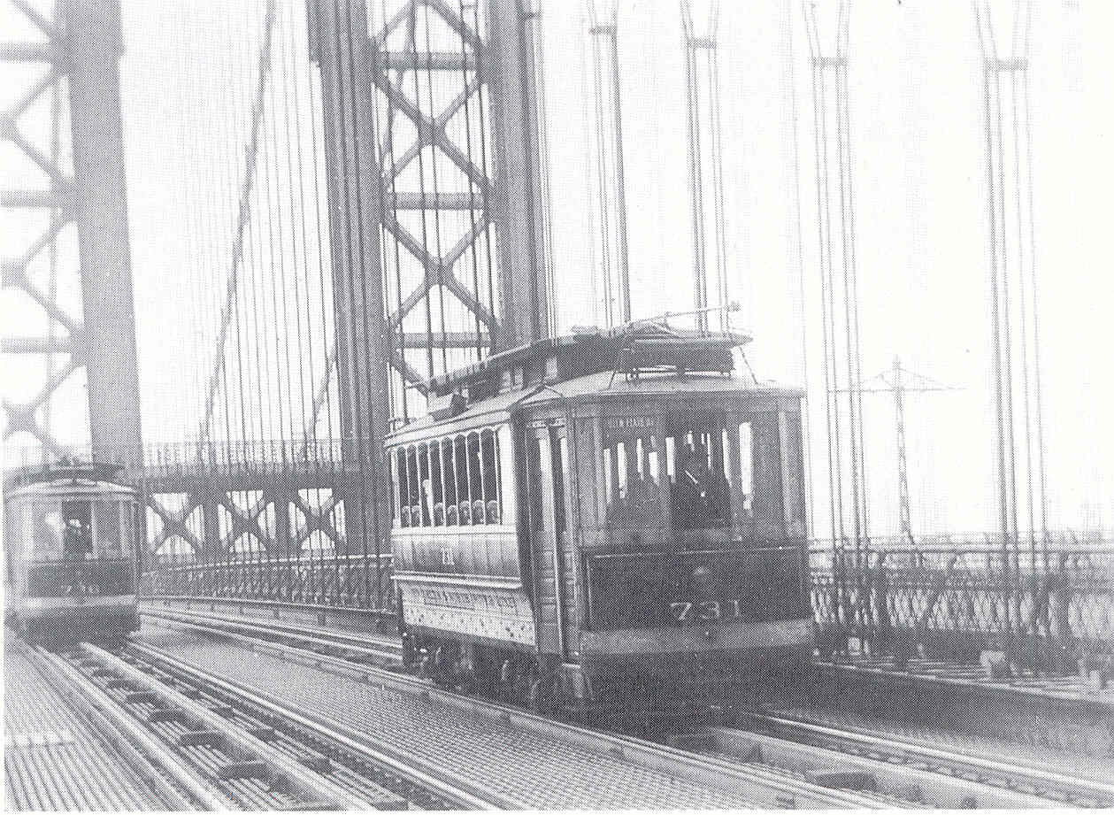 Over the years, bridge lanes devoted to high-capacity trolley and subway lines were gradually converted to auto lanes by motoring interests who had gained control of City Hall. In this rare photo, we see a dual-electric trolley on the upper level of the Manhattan Bridge, before this public asset was usurped for motor vehicles. The auto lanes, of course, have drastically lower passenger-carrying capacity. Now, with bridge tolls being discussed, some motorists and the usual more backward politicians reject the claim that drivers should stop their freeloading and contribute to the maintenance of the bridges to which they are now the main user. (We hope to post a better graphic representation of this chart soon. Perhaps the Dept. of Transportation will release an update.] |